MapItFast
MapItFast
The official app & game
Distributed by UptoPlay
SCREENSHOTS
DESCRIPTION
Play this online game named MapItFast.
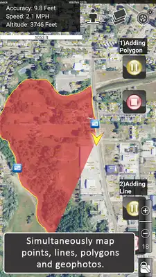
Try a unique approach to mapping that turns your phone into a GPS mapping machine and makes data collection for GIS systems fast and easy for anyone. A single tap is all you need to instantly gather points, lines, polygons or geophotos. MapItFast works offline in remote areas and provides GIS professionals with easy yet accurate data collection and mapping tools that work on Android and Apple devices.Although MapItFast is advanced enterprise software, it requires virtually no training or GIS knowledge to use.
Field workers and natural resource professionals use MapItFast for activities such as:
• Vegetation management & pesticide application reporting
• Inspections/surveys
• Crop scouting
• Wildfire and disaster response
• Utility work & forestry monitoring
MapItFast Features:
• Simultaneously map points, lines, and polygons with a single tap
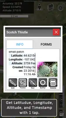
• Add geophotos based on GPS location to any map
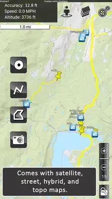
• Access free basemaps
• Work in online and offline mode
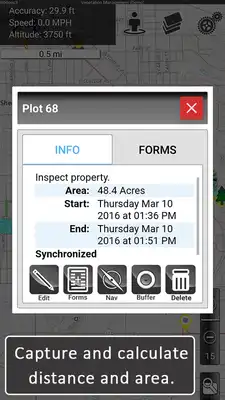
• Instantly calculate length and area
• Streamline data collection and project management
• Enjoy this free app with NO ads
The paid version enables you to create an unlimited number of projects and use custom designed forms to simplify GIS data collection. All your maps and data are centrally warehoused and accessed by authorized users. Paid version features:
• View projects, users and shared contributions via a live mapping dashboard
• Add custom designed map driven forms with dropdowns, picklists, input boxes,
photos, signatures and more for attribution
• Automatically change map symbology based on how a form is filled out
• Include printable reports customized with company logos, table layouts, maps, photos
and more
• Add offline and customized basemaps and layers (including MBTiles)
• Import shapefiles as editable map objects or layer overlays
• Export to all major GIS formats including KMZ, Shapefile (SHP) and GPX
• Perform two-way, real-time synchronization of maps and data between all mobile
devices and the web
• API available to integrate with third party GIS databases and database software such
as Esri ArcGIS geodatabases
• Add plugins for AgTerra’s dataloggers including SprayLogger, FoggerLogger and
SnapMapper
Discover all the additional features included in a paid subscription.
Simplify mapping and easily manage data while improving field workforce efficiency for the entire organization.
• See more details in the product video.
• Learn more about all our products at www.agterra.com.
Updates:
Build tank mixes on the flyAbility to set how many gallons are in your tank
New overlays/Basemap menu
Improved shapefile handling
Offloading pictures to SD Card
Fix for form's shifting from new points
Crash fixes and bug fixes and form fixes
MapItFast from UptoPlay.net
Page navigation:


